
Cambodia 03丨Siem Reap, Angkor Wat (Part 1)
Continue to set off, leave the small and beautiful Battambang, and go east for more than 100 kilometers, and arrive at Siem Reap, the most famous tourist city in Cambodia.
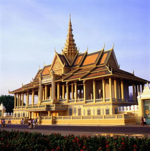
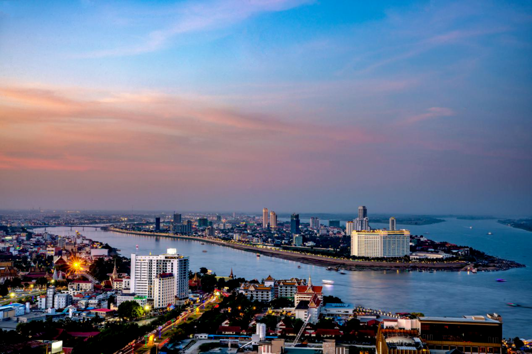
【Siem Reap】
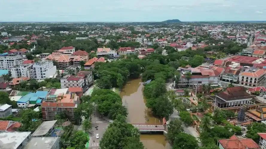
The picture shows a panoramic view of Siem Reap
Siem Reap is famous worldwide for its Cambodian national treasure Angkor Wat. Angkor Wat first pressed not to say it, and then talked slowly.
In Khmer language, "Siam" refers to "Siam (ancient name of Thailand)," and "Li" means defeating, so Siem Reap means defeating Siam. Ironically, Siem Reap has been under the control of the Siamese army since the fall of the Angkor Dynasty, until France forced Thailand to return Battambang and Siem Reap in 1907.
Tonle Sap Lake
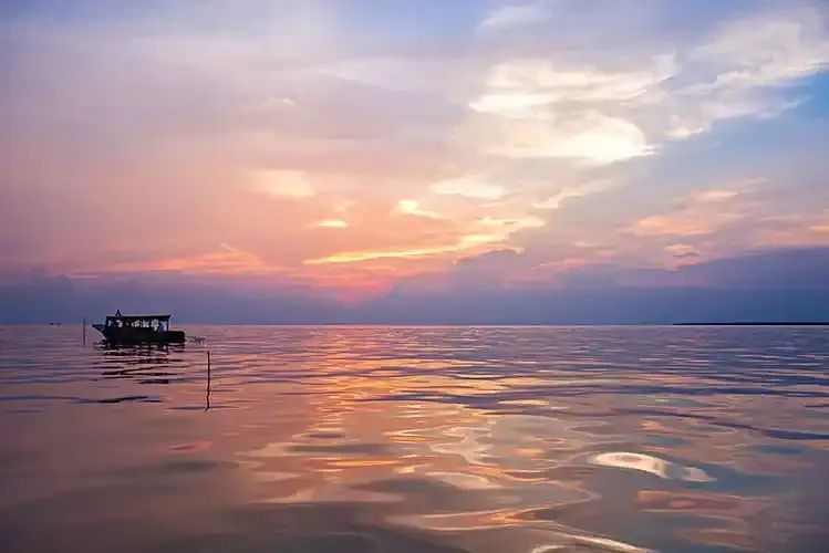
The picture shows the sunset on Tonle Sap Lake
More than ten kilometers south of Siem Reap, you will reach the shore of Tonle Sap Lake. As mentioned earlier, Tonle Sap Lake is the largest freshwater lake in Southeast Asia and also the lake of life in Cambodia. Tonle Sap Lake is connected to the Mekong River in Phnom Penh through Tonle Sap River, which has a unique hydrological phenomenon. During the rainy season, the Mekong River water level is in a flood season, and the river flows into the lake through the Tonle Sa River. The area of Tonle Sa Lake has expanded to 4 times the original level, with an average water depth of more than 10 meters, which not only effectively controls floods, but also irrigates the surrounding land; and during the dry season, the Mekong River is in a dry season, and the lake water is replenished to the Mekong River through the Tonle Sa River. The lake area has shrunk, with an average water depth of only about 1.5 meters. The exposed land is fertile and suitable for planting various crops, and it also ensures the navigation water level in the lower reaches of the Mekong River.
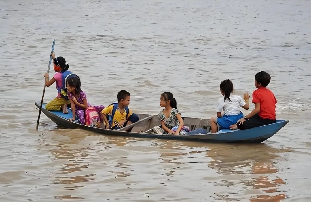
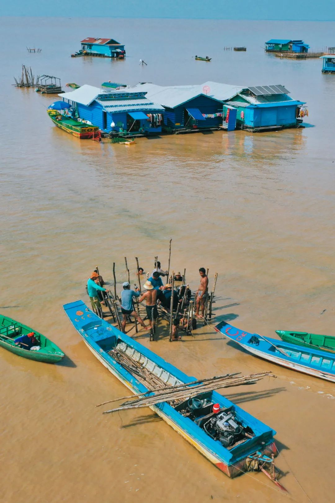
The picture shows residents on Tonle Sap Lake
Tonle Sap Lake has a rich fishery resources, with more than 197 species of fish, including Mekong giant catfish, one of the largest freshwater fishes, with a length of up to 3 meters. The annual catch volume reaches 760,000 tons, accounting for 60% of Cambodia's total output. According to statistics last year, about 3 million people live around Tonle Sap Lake, and most of them make a living by fishing. About 700,000 of them live in Shuishangfu Village.
Water Floating Village
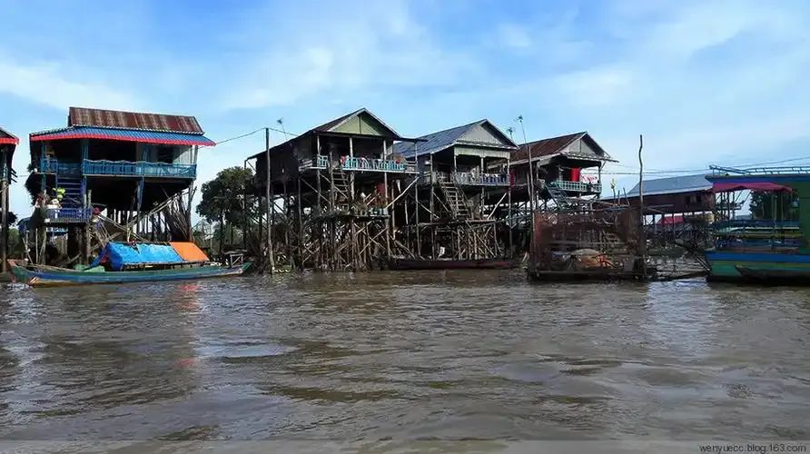
The picture shows a photo of the water floating village during the dry season
The floating village is a unique landscape by Tonle Sap Lake. People live in high-legged houses built on the shore, and do business on land during the dry season; in the rainy season, the lake water floods the bottom of the house and can only travel by boat. The Floating Village has a complete range of facilities, including shops, schools and hospitals, and has now become a must-check-in attraction for Tonle Sap Lake.
The picture shows a photo of the rainy season of the floating village on the water.
But on the other side of the floating village, it may not be that beautiful. Some people are Cambodians who live here because of poverty, while the other are people with no nationality or status. They will never be able to leave this village in their entire lives. Most of these people were refugees who fled from Vietnam to Cambodia during the Vietnam War. After the war, Cambodia naturally would not recognize their identities because Cambodia was a feud, while Vietnam believed that these people were traitors and refused to accept them back to China. As a result, these people became homeless black households, and could only live in floating villages, not protected by law, and faced continuous discrimination and exclusion.
【Angkor Wat】
The picture shows the outdoor scene of Little Angkor
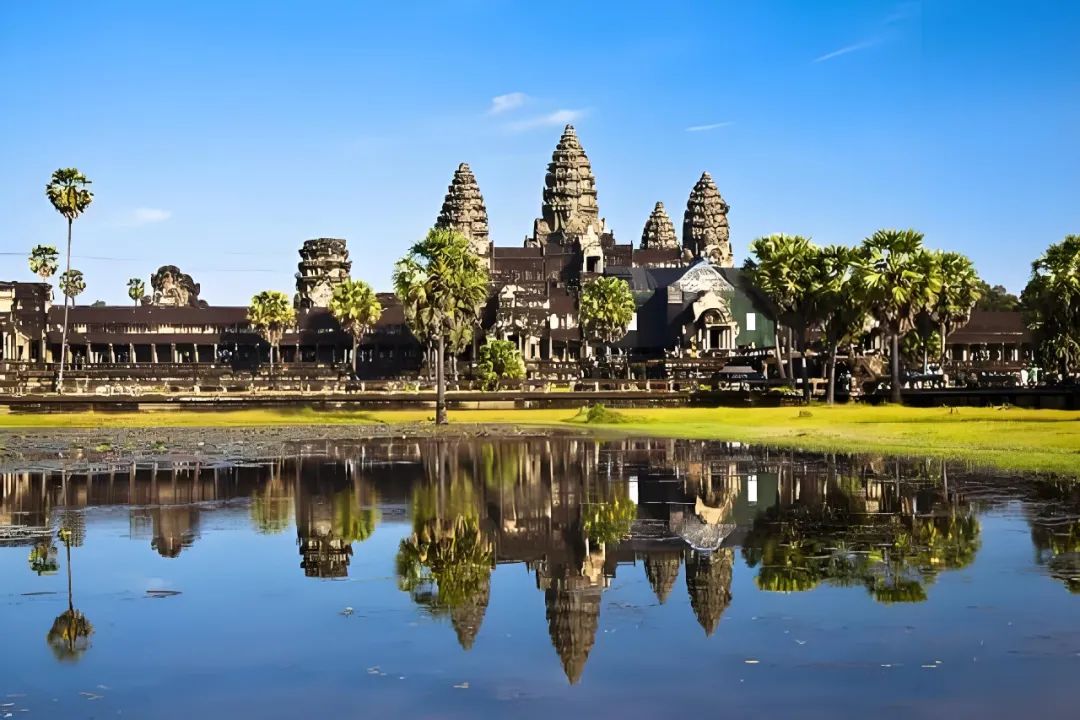
Finally, we are about Angkor Wat. This place, known as one of the four wonders of the East, may be more famous than Cambodia. Let’s make a brief overview first.
Angkor Wat, "Angkor" means "city" in Khmer language, and "Wat" refers to "the temple", so "Angkor Wat" literally means "the temple of the capital". This reflects its position as an important religious building and city core during the Angkor dynasty.
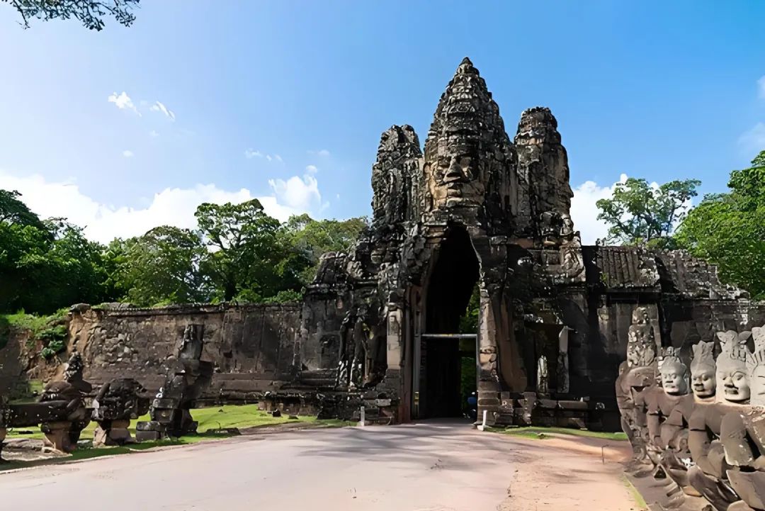
The picture shows "Angkor's Smile" at the south gate of the King of Angkor Tong City
However, after the Angkor Dynasty declined and moved its capital to Phnom Penh, the entire Angkor was abandoned and hidden in the primitive jungle. It was not until 1861 that a French biologist named Henry Muo accidentally discovered the magnificent Angkor Wat building in the dense forest during an expedition, and recorded it in words and sketches. Muo unfortunately died the following year, but his diary shocked the world after it was published in Europe and unveiled the mystery of the Angkor dynasty.
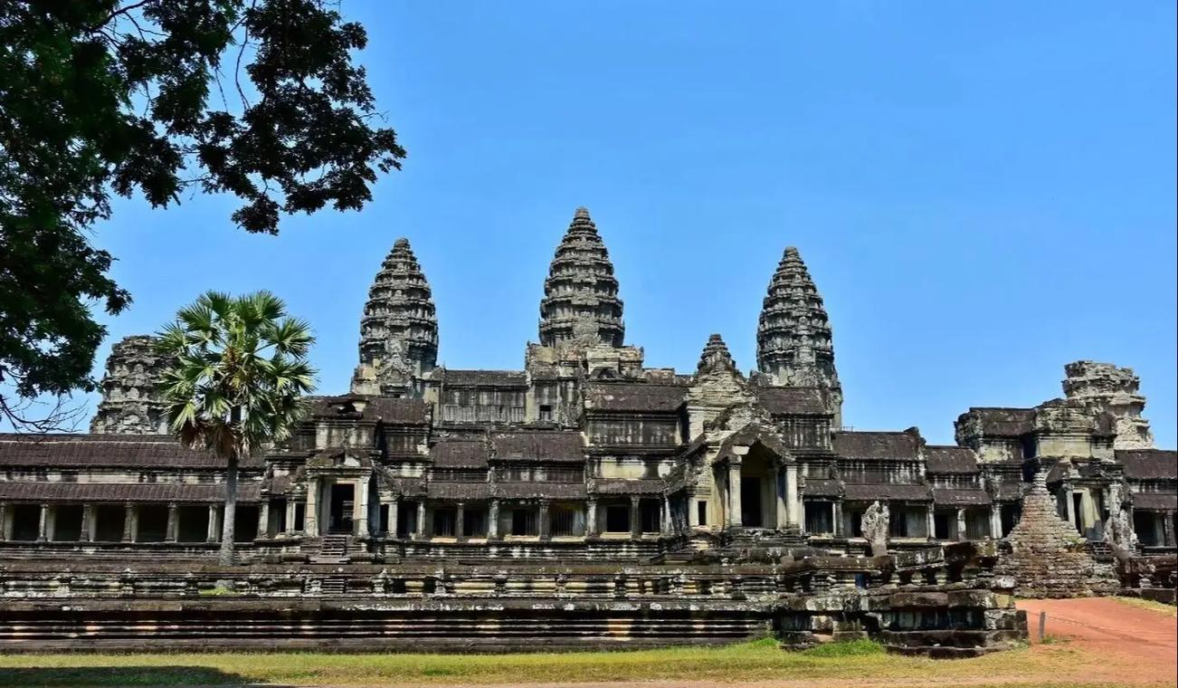
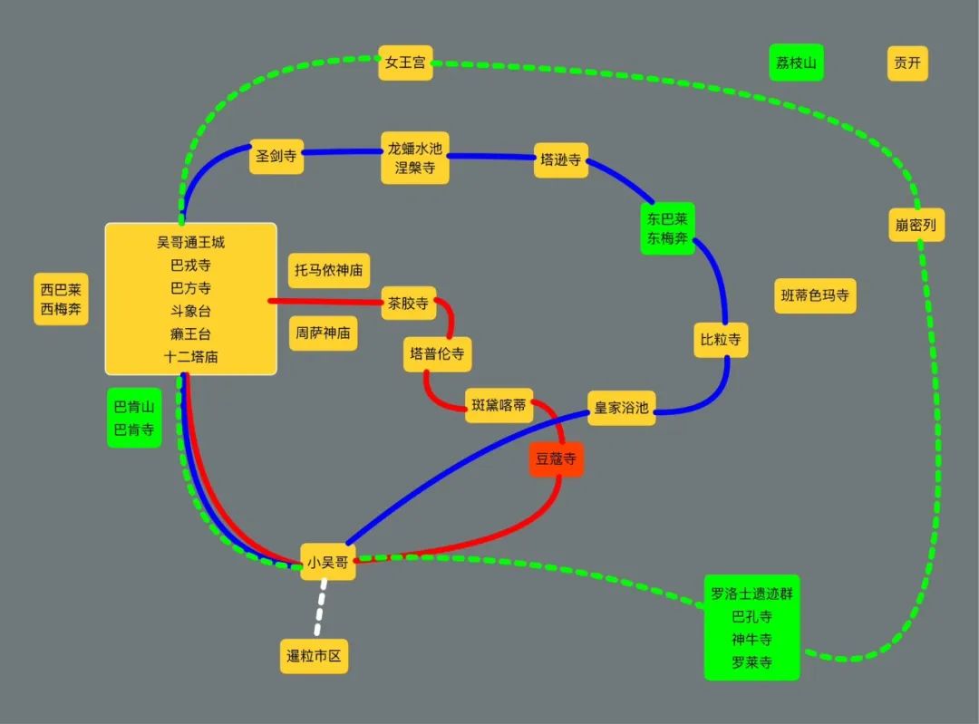
Angkor Wat is divided into two concepts: in a narrow sense, it refers to the part of the Angkor ruins group called "Angkor Temple", which is the most well-known building, also known as "Little Angkor"; in a broad sense, it refers to the entire Angkor ruins group, including many temples such as Little Angkor, Tongwangcheng, Queen's Palace, and Benmilie, covering a total area of 400 square kilometers.
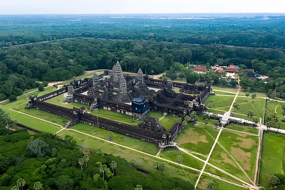
The picture shows a view of Little Angkor
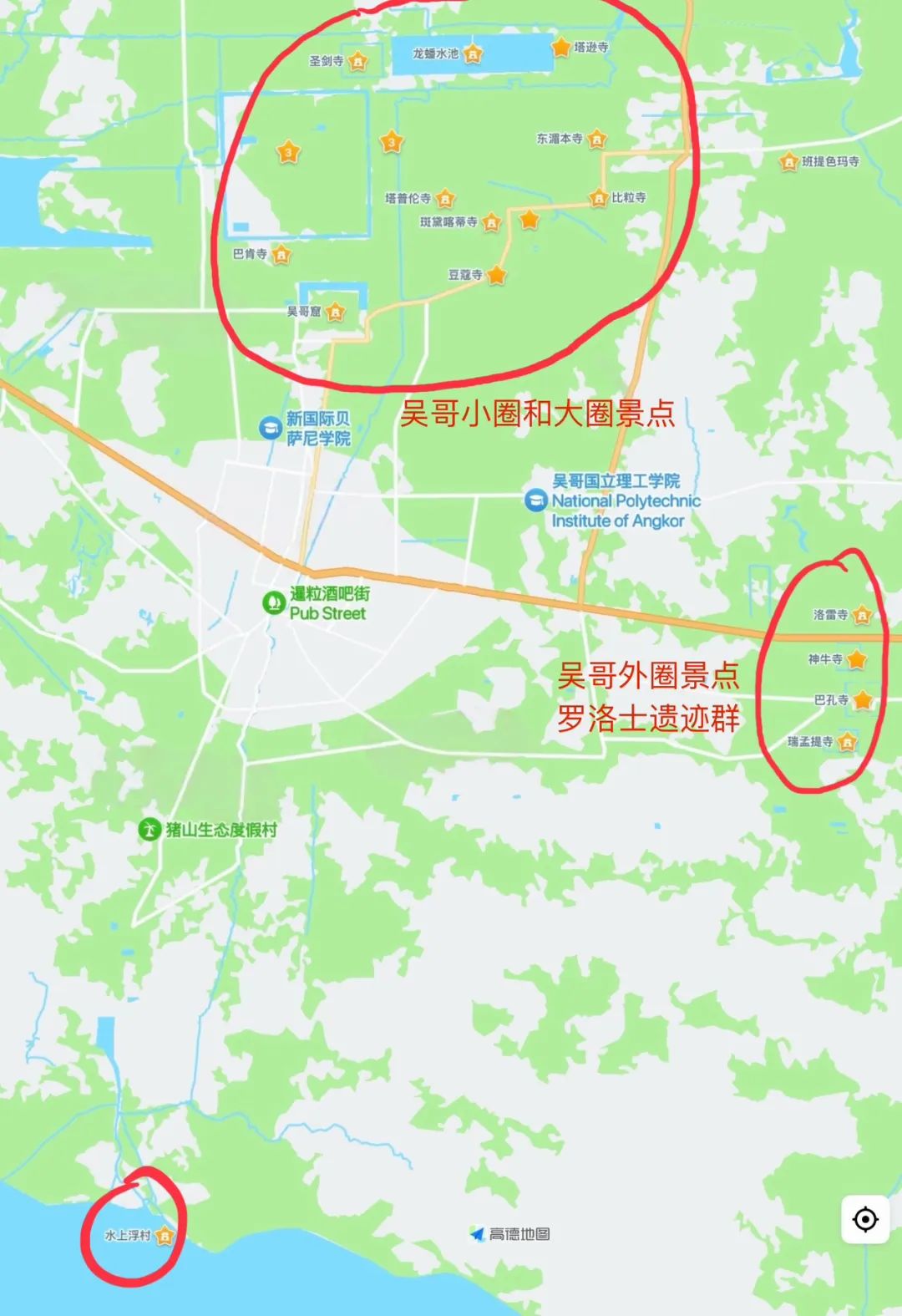
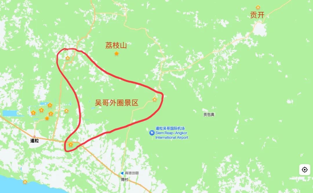
Due to its huge area, most of them are surrounded by tropical rainforests, and there are even landmines left over from war. Therefore, if you want to visit the entire Angkor Wat, it is customary to be divided into three routes, small circles, large circles and outer circles, and each circle takes one day. Although there are not many attractions in the outer circle, the distance is relatively far. The farthest Benmilai is 40 kilometers away from Little Angkor.
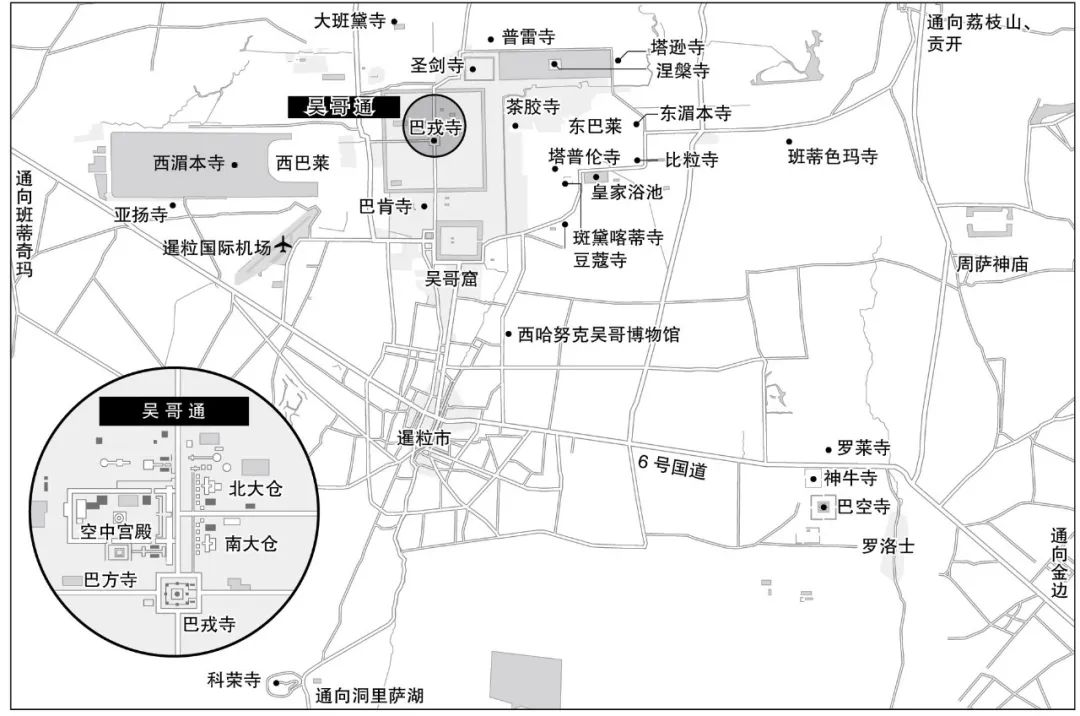
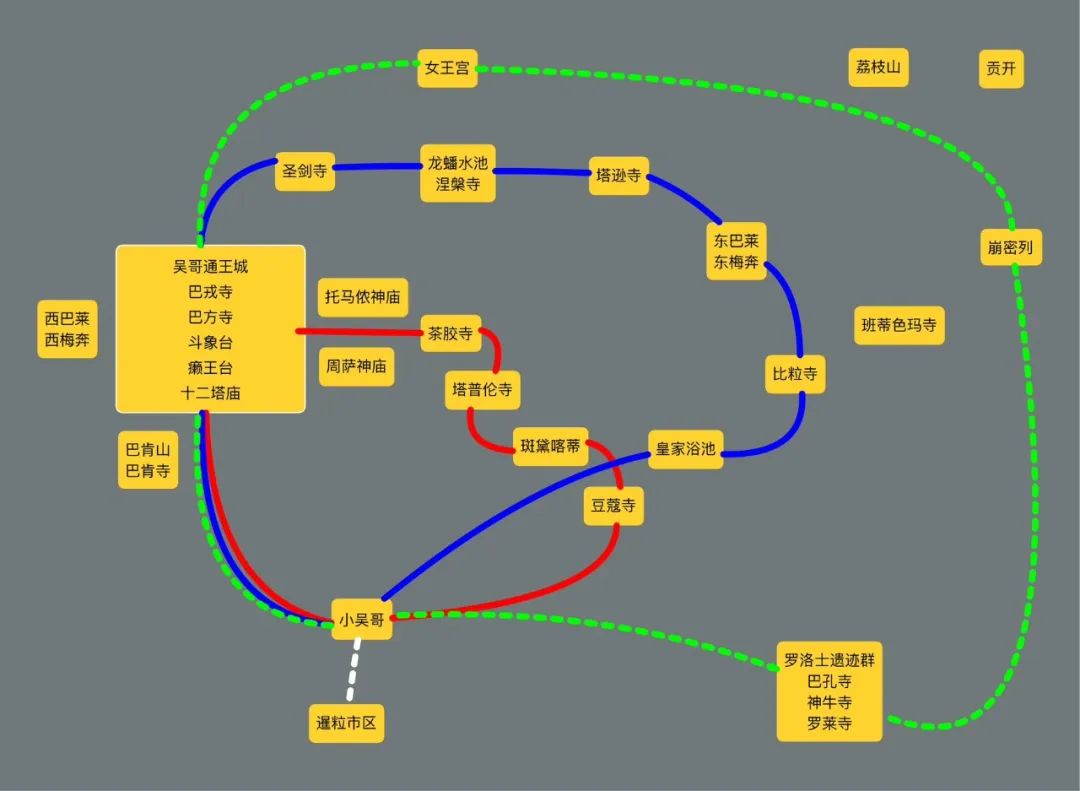
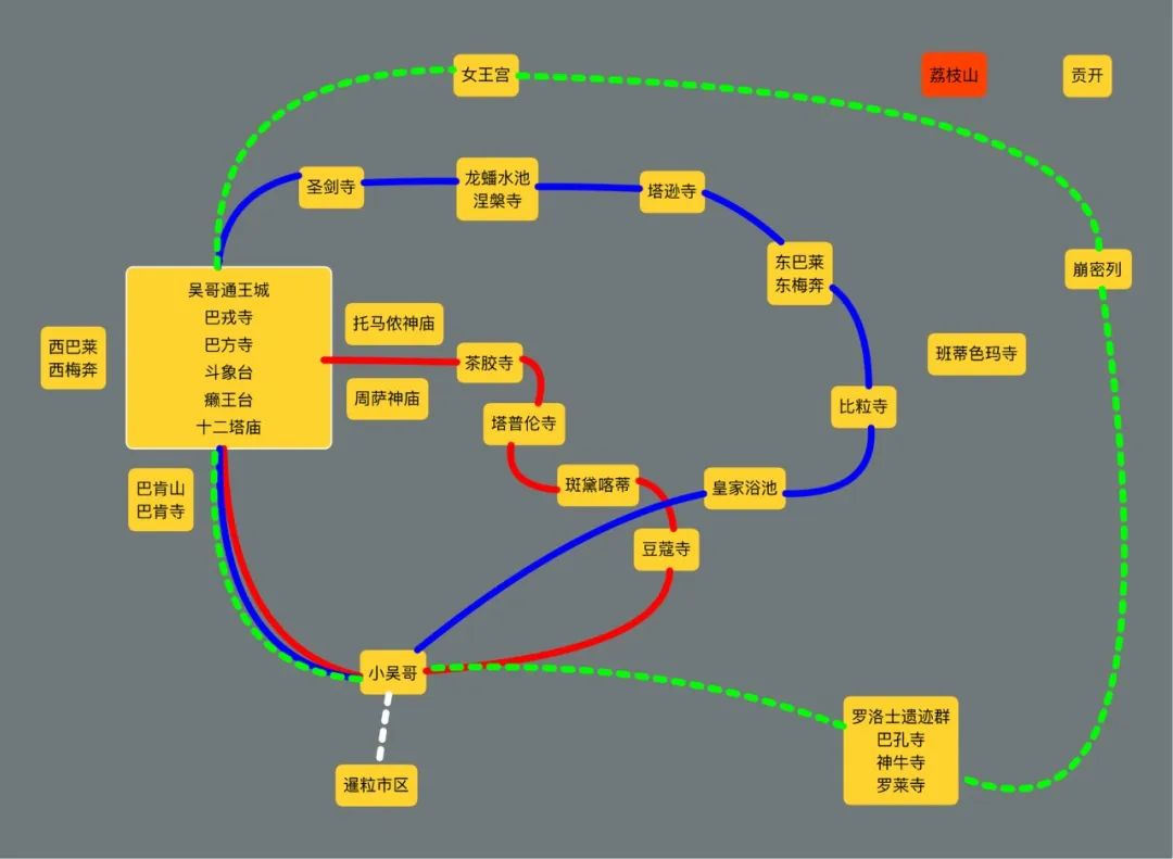
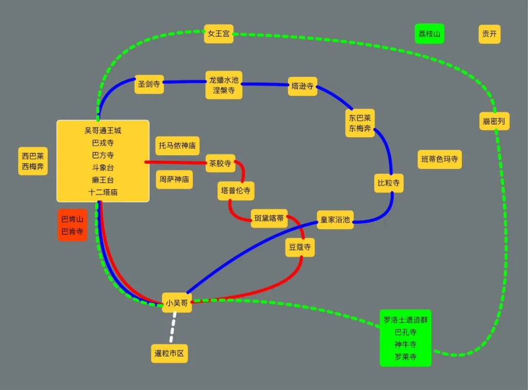
The picture shows a simple version of Angkor road map
Everyone may be dizzy when they see so many stars in the map, so I specially used the mind map tool to make a concise roadmap. However, I will not follow the tour route later. It is more chaotic to intersperse in different periods. I will use the order of the Angkor throne to see the development of buildings in different periods and use time to connect space. First, I presented the throne list of the Angkor Dynasty, and then I called them by serial numbers.
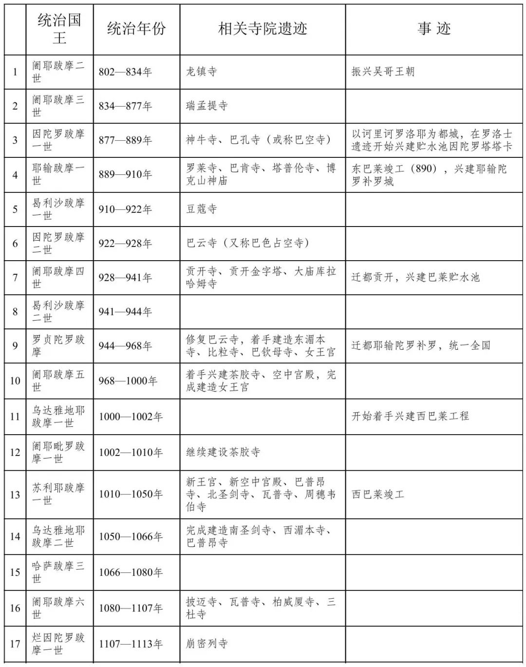
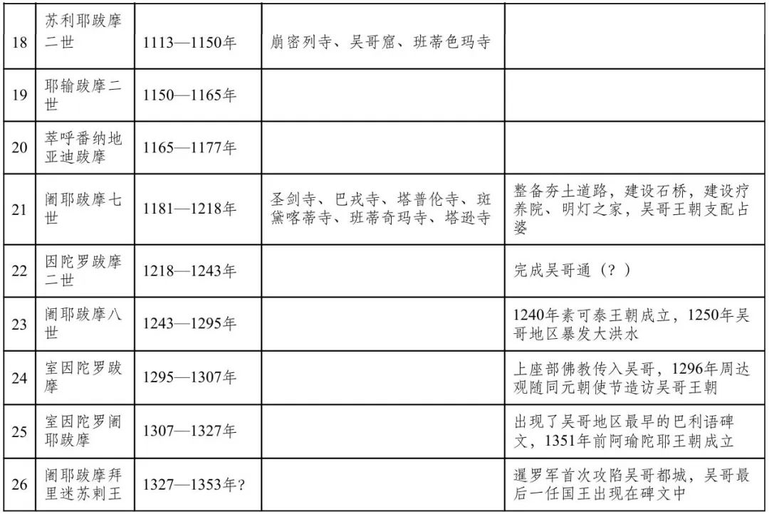
The picture shows the throne list of the Angkor dynasty dynasty
Lizhi Mountain and Siem Reap River
The picture shows the location of Lizhi Mountain
In the 8th century, the Zhenla dynasty in Cambodia was in troubled times and the heroes were in power. The nearby Javanese invaded Cambodia and kidnapped the prince of Zhenla. When the prince became an adult, he sneaked back to Cambodia. In 802 AD, he became king with the support of his old ministers and established the capital of Lizhi Mountain. Since then, the Angkor Dynasty was established. This is the founding emperor of Angkor, the youngest, Jayavarman II. In the following decades, the youngest fought south and north, broke away from Java's rule, recaptured other separatist forces, and unified the country.
Part of the reason why the capital was built on Lizhi Mountain was due to the Brahman beliefs of people at that time. They regard Lizhi Mountain as the Brahman holy mountain "Summer Mountain", the flowing Siem Reap River as the holy river "Ganish River", and the capital at the foot of the mountain as the Ayudah in "Mahabharata". Another part of the reason is geographical advantages. The Siem Reap River crosses and strikes a large fan-shaped plain in the southern part of Lizhi Mountain. The land is fertile and suitable for cultivation. This also led to almost no capital in the following 600 years leaving this large plain.
The youngest once built temples on the top of Lizhi Mountain and Rolos, but because it was too long, it could no longer be studied.
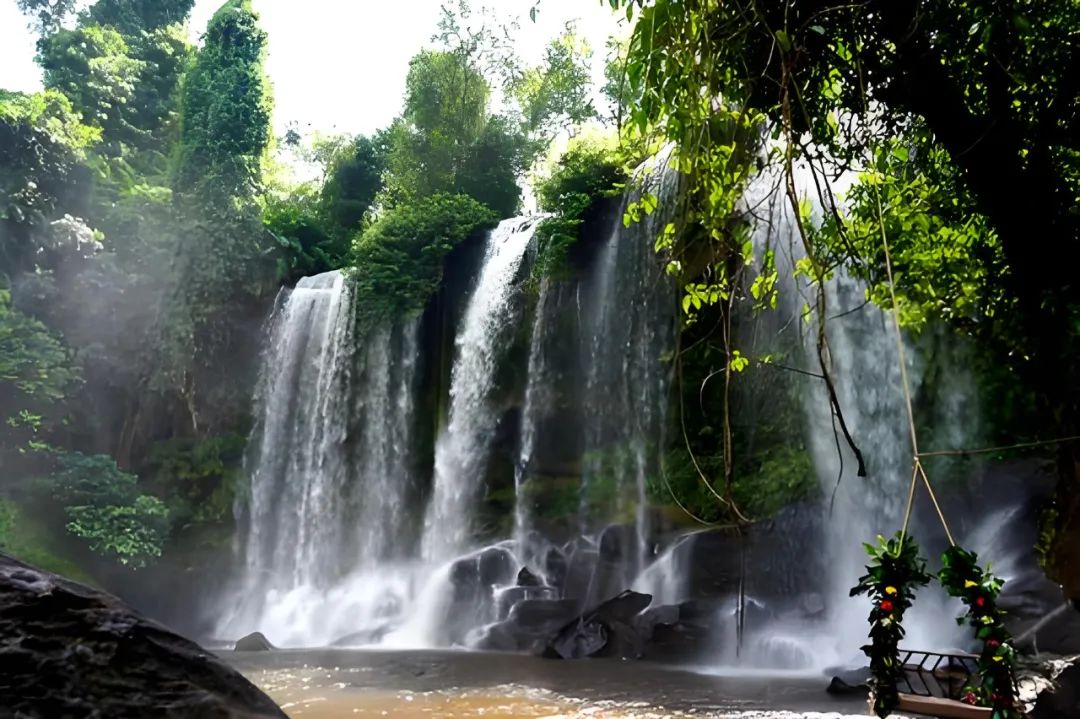
The picture shows the waterfall on Lizhi Mountain
In 850 AD, the youngest son, Lao Er, succeeded to the throne. His greatest achievement was to move the capital to Luoluoshi. No buildings were left behind. After 27 years of reign, the third brother usurped the throne.
Rollos ruins group
The picture shows the location of the Rollos ruins group
Although the third brother usurped the throne and had only been in power for 12 years, he led Angkor to his first heyday. The third brother was an infrastructure maniac. During his tenure, he built Bakong Temple and Shenniu Temple, and also created a paradigm for later kings: as a king, three buildings must be built: the capital, the temple and the palace. This requirement is actually quite high. First, we must have peace and stability in the country and have the freedom to build it; second, we must have sufficient financial, material and labor, and finally, we must live for a long time. Such a large project will take at least 10 years. There were 26 kings in the Angkor Dynasty, and only 6 could complete the three building indicators, and the third brother was the first. Let’s take a look at his masterpiece together.
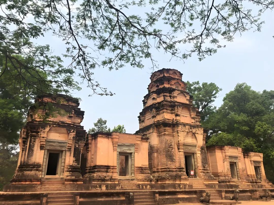
Bakong Temple (Bakong)
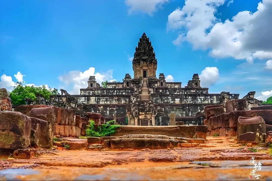
The picture shows a panoramic view of the central temple of Bakong Temple
This was the third-year-old temple at that time. It was built in 881 AD. It was the first multi-story tower building in Angkor and the first temple with sandstone blocks. It consists of three concentric corridors and two moats. The main axis guide runs across the east and west, and the main gate faces east. Enter from the east gate and cross the outer moat. There are 22 satellite temples built with red bricks in the area between the inner and outer moats, and then cross the inner moat. The inner city area is built with the pyramid of the Central Temple and the surrounding eight red brick towers. Unfortunately, everything I said above is already broken. The red brick structure is easily damaged and collapsed. The inner moat has long been dry. The only thing that is complete is the outer city river and the pyramid of the central temple restored by France.
The Central Temple is a five-story square pyramid with animal statues built on the edges of each floor, and a five-story pagoda stands on the top platform. The pagoda is a typical Brahman Sikarlo style, tightening layer by layer like corn cob. The symbol of Shiva, the pagoda was originally worshipped, but it has now been converted into a Buddhist temple. The most unique thing about Bakong Temple is its pyramid-shaped structure. It can be said that the entire temple is built according to the concept of "Summer Mountain".
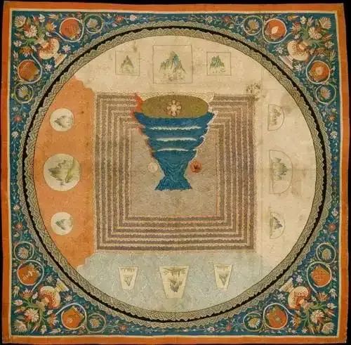
The picture shows a Brahmin Mountain painting of Mount Sumeru
The so-called "Meru" is the holy mountain of Brahmanism, the residence of God, the center of the universe, and the axis of the rotation of the sun, moon, and stars. Mount Sumeru connects the heaven, the earth and the region, and is shaped like an inverted cone. There are seven levels in the sky and underground. The highest level is the residence of the creation god Brahma, Shiva and other gods live on the hillside, and the foot of the mountain is the residence of the Asuras, who are half-demon and half-god. And at the foot of the mountain there are seven layers of areas, each layer has different ways of punishment, symbolizing karma and retribution. A small world surrounded by seven fragrant seas and seven golden mountains around Mount Sumeru, the height of the mountain decreases in half in sequence, forming a regular cone. Further out of the small world is the Aral Sea. Four continents are floating on the Aral Sea, and humans live in the South Continent. There is a circle of iron mountains surrounding the Aral Sea. This is the world view of Mount Sumeru. Later, Buddhism revised and followed this setting, but it did not pay as much attention to Brahminism. Now go back to Bakong Temple to compare.
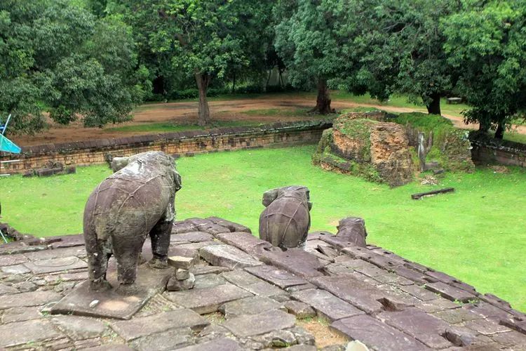
The picture shows an animal statue taken from the top view of Bakong Temple
The outermost moat symbolizes the Aral Sea, the concentric corridor and the inner moat symbolize the seven mountains and seven seas, while the five-story central temples gradually decrease in the small world and also represent the class of the gods, from low to high, namely Naga, Golden-winged bird, Rakshasa, Yaksha and the gods. The Sikarlo-style pagoda at the top is very similar to the layout of a small world. The higher the pagoda, the closer it is to Mount Sumeru. If you can overlook the entire Bakong Temple, you will find that the entire temple is symmetrical in the center. This is also a typical mandala layout in the Po Buddhism, referring to the holy flower of the Po Buddhism.
The picture shows the central tower of Bakong Temple
This mandala layout, Mount Sumeru concept and Sikarlo style also became templates for later generations to build temples. Although there have been evolution and development, they will never be separated from their sects. After explaining the Bakong Temple clearly, you can simply write it down afterwards haha.
Shingyuji Temple (Preah Ko)
The picture shows a panoramic view of Shenniu Temple
This is the oldest temple in the ruins of Rolos. It was built in 880 AD and was built by the third son to worship his ancestors. The entire Shenniu Temple consists of six red brick towers. The towers are built on a sandstone platform and are divided into two rows, each row of three. The front row is dedicated to three kings and the back row is dedicated to three queens, all facing the east. The tower in the middle of the front row is the tallest, with three sandstone bull statues in front of the tower, which symbolizes the mount of Shiva, the god of the cattle "Nandi", and is also the origin of the name of the temple.
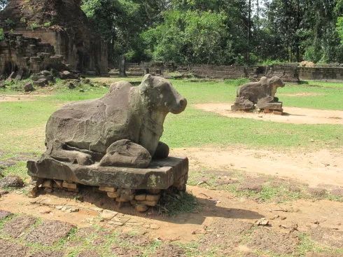
The picture shows a stone cow statue in front of the gate of Shenniu Temple
Lolei Temple
In the blink of an eye, the third brother died, and a fierce war of succession to the throne broke out in Angkor. In the end, the fourth brother, who had military talents, won the war and inherited the throne. At that time, Luo Luoshi was almost damaged by the war. After Lao Si built the last temple here, Luolai Temple, he ordered the capital to be moved.
Luolai Temple, built in 893, is also a red brick building. It is a temple used by the fourth son to worship his ancestors. The Luolai Temple consists of four towers, with a cross-shaped sink built between the four towers, and the statue of Shiva Linga at the intersection. Luolai Temple was originally built on an island with an artificial pool, but now it has dried up, and only one tower is still complete.
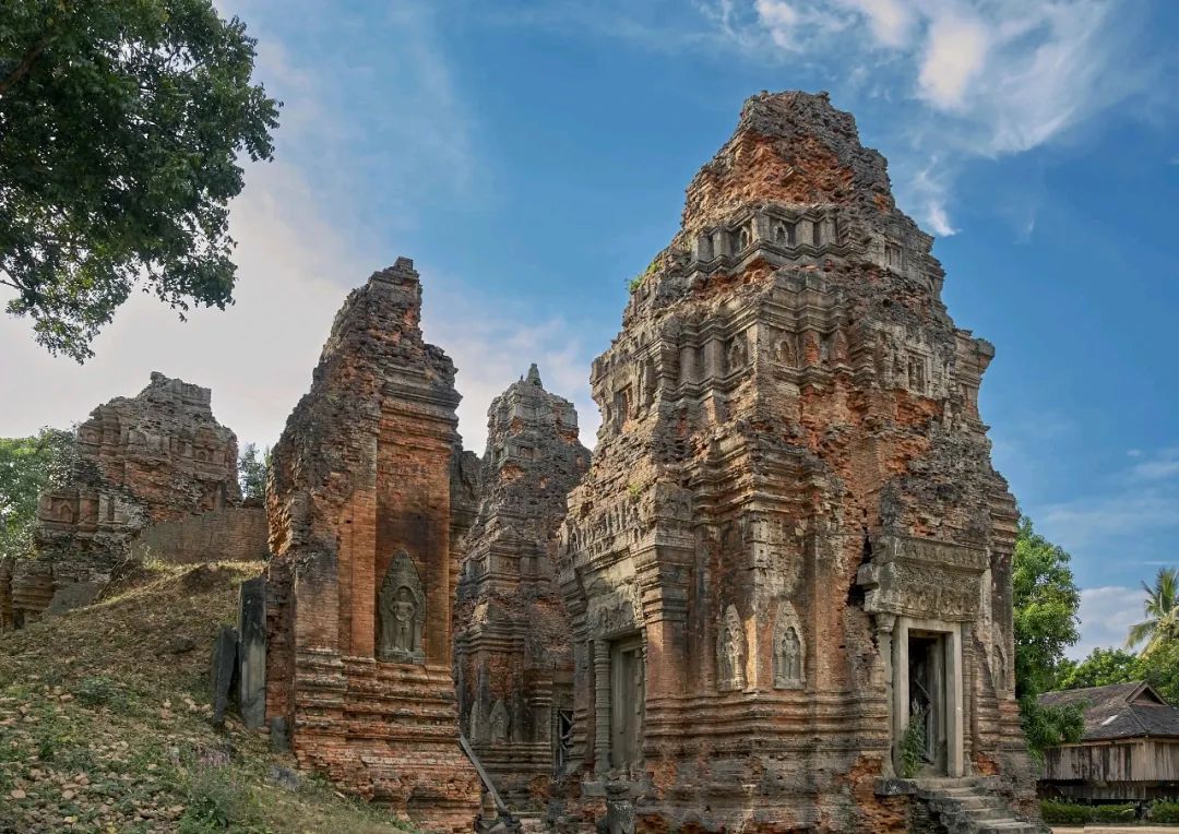
The picture shows a panoramic view of Luolai Temple
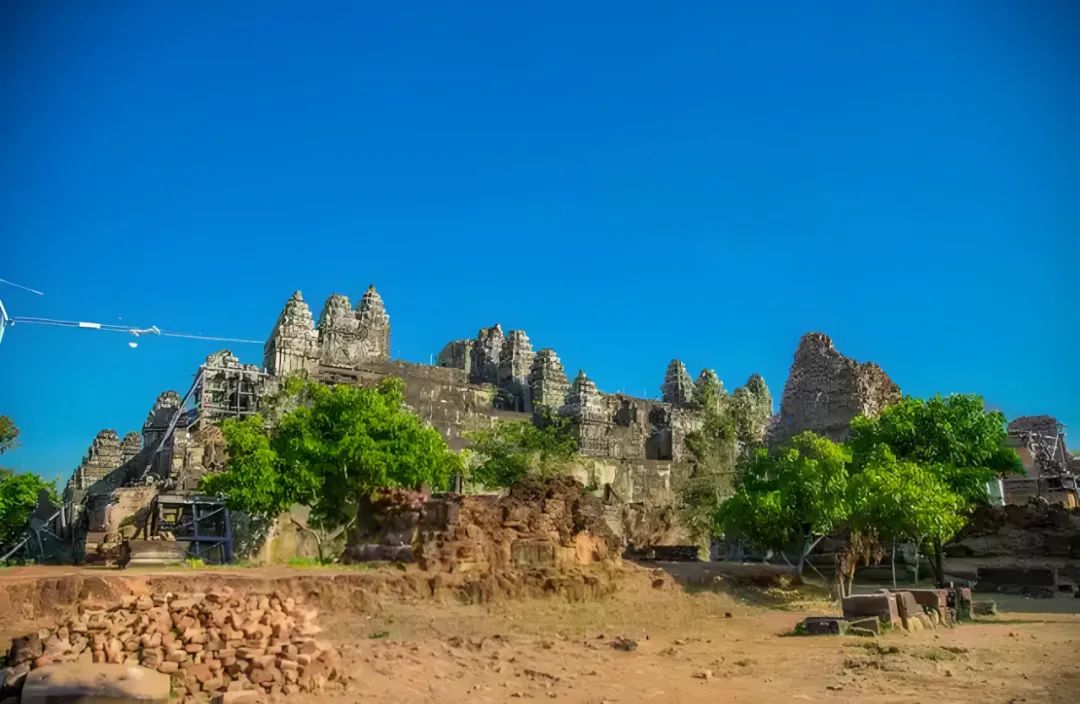
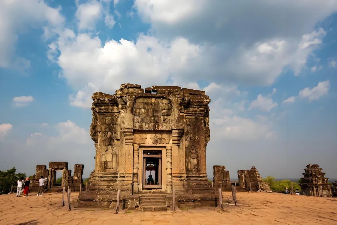
Phonm Bakheng
The picture shows the location of Mount Bakken and Monastery
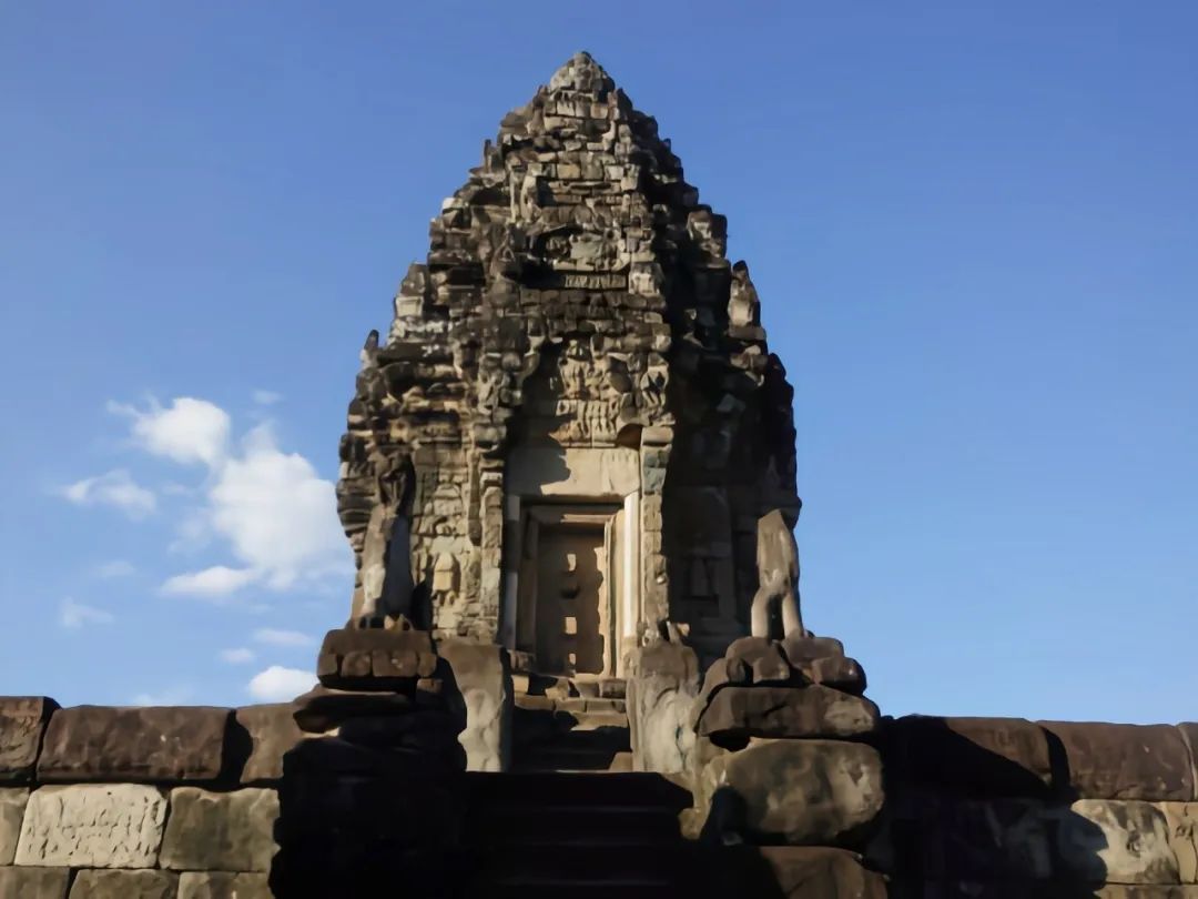
In 893 AD, the fourth Laozi established a new capital next to Mount Bakken and built a new national temple, Bakken Temple, on the top of Mount Bakken. Bakken Mountain is a hill about 67 meters high. The Bakken Temple on the mountain is the only commanding height in the Angkor region.
Bakan Temple is similar to the large Bakon Temple. It is also composed of five-layer square bases, 13 meters high, 76 meters long at the bottom, decreasing layer by layer to 47 meters on the top floor. There is a steep stone steps in the center of the four sides of the base, one layer and ten levels, and each layer of stone steps is guarded by a lion on the left and right.
The picture shows a view of Baken Temple from the bottom of the mountain
The most unique part of Bakken Temple is the lot of pagodas, with a total of 109 towers, so you can count them. There are 5 towers on the top floor, the largest one is in the center, one in each corner, which symbolizes the five peaks on the top of Mount Sumeru; there are 20 corner towers on each corner of the five-story square; there are 40 towers on both sides of the stone steps on each floor; there are 44 towers on each side, with 11 towers on each side. These 109 towers symbolize 109 rosary beads of Vishnu, the larger one is called the "Summer bead", and the other 108 symbolize the balance between thought, spirit and body, and are a sacred number. If you look at any side of the temple, you can only see 33 towers, and 33 symbolizes the level of Brahman gods. There are 11 levels each in the heaven, the sky and the earth, for a total of 33 levels.
The picture shows the central tower of Bakken Temple
It can be said that there are quite a lot of symbolic elements in Bakken Temple, but unfortunately some towers have been damaged and collapsed, and several towers on the top floor have been restored. Since it is the commanding heights of Angkor, the top floor is an excellent place to watch the sunrise and sunset, and you can also look at the little Angkor in the jungle.
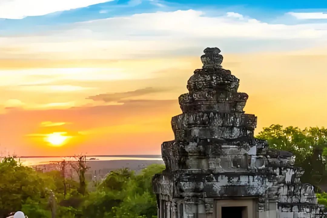
The picture shows the sunset on Mount Bakken
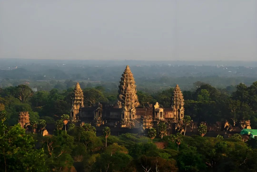
The picture shows Little Angkor looking away from the distance on Baken Mountain
East Baray

The picture shows the location of Dongbale
In Angkor, "Bale" refers to large water storage pools, mainly used to irrigate and regulate water resources. Dongbalai was ordered by the fourth brother. It was built in 900 AD and is located on the east side of the current Angkor Tong royal city, so it is now called "Dongbalai". Dongbale is rectangular, about 7.5 kilometers long and about 1.8 kilometers wide from north to south. The total water storage capacity exceeds 55 million square meters. Dongbalai has now dried up, and the lake bed has been reclaimed into farmland. Only the remains of dams with a height of 10 and the Dongmei Ben Temple on the central island can also confirm the glorious water conservancy construction of the Angkor dynasty at that time.
The picture shows another Balai in Angkor area - Longpan Pool -
In fact, the prosperity of the Angkor dynasty is closely related to the development of water conservancy projects. Because it is in a tropical monsoon climate, it may not rain for several consecutive months during the dry season, so it is very necessary to build barai water storage. Barre first solved the problem of agricultural irrigation, which made it possible to plant rice in two seasons a year, greatly improving agricultural productivity. The increase in grain output not only promoted population growth, but also promoted handicrafts and trade exchanges, and the economy also developed rapidly. Water conservancy projects also supported the construction industry in disguise, transporting huge rocks through the water system, making it possible to build a more magnificent temple. However, some scholars have also shown that the final decline of the Angkor dynasty is related to the expensive maintenance costs of water conservancy projects, which is a success or failure of water conservancy.
Prasat Kravan
The picture shows the location of Cardamom Temple
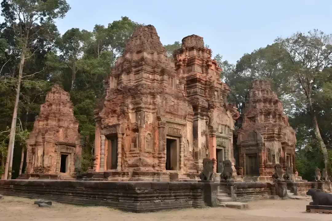
After the death of the fourth brother, the regimes of the fifth brother and the sixth brother were relatively weak, and separatist forces in various places rose up and rebelled, and the country was in chaos. The two men's rule was not as long as the fourth one, so there was no large-scale building built. The only thing worth mentioning is the Cardamom Temple on the east side of the royal city.
The Cardamom Temple was built in 921 AD. Some people say that this was not a masterpiece of the Wuwu, but was built by the nobles. The temple faces east and is surrounded by a small moat. It is a flat-style temple built entirely of red brick structures. There are a total of five brick towers, arranged from south to north, built on the same platform. The brick tower in the middle is the tallest, and a gate tower is built on the small platform at the entrance. Many of them have been damaged now, the gate tower and moat no longer exist, and only the five brick towers in the middle and south retain the top structure.
The picture shows a panoramic view of Cardamom Temple
Overall, the materials and layout of Cardamom Temple are relatively simple, and the biggest highlight is its relief art. At that time, the literacy rate of the people of Angkor was particularly low. In order to spread religion and consolidate the regime, the monarch spared no effort to decorate reliefs in places where he could see. So you will find that as long as it is Angkor's buildings, there are various reliefs inside and outside, and most of them depict myths recorded in Indian epics. As time goes by, the carving skills are also improving, and the reliefs of the Cardamom Temple feel a lot of progress.
The reliefs inside the main pagoda of Cardamom Temple depict the myths of Vishnu. For example, Vishnu rode the golden-winged bird of the great roc and Vishnu's God Concubine Auspicious Heaven, etc., can still see many details, which are vivid. Not only that, carving on red bricks is itself extremely challenging. The red bricks are hard and fragile, and have high requirements for the strength of craftsmen.
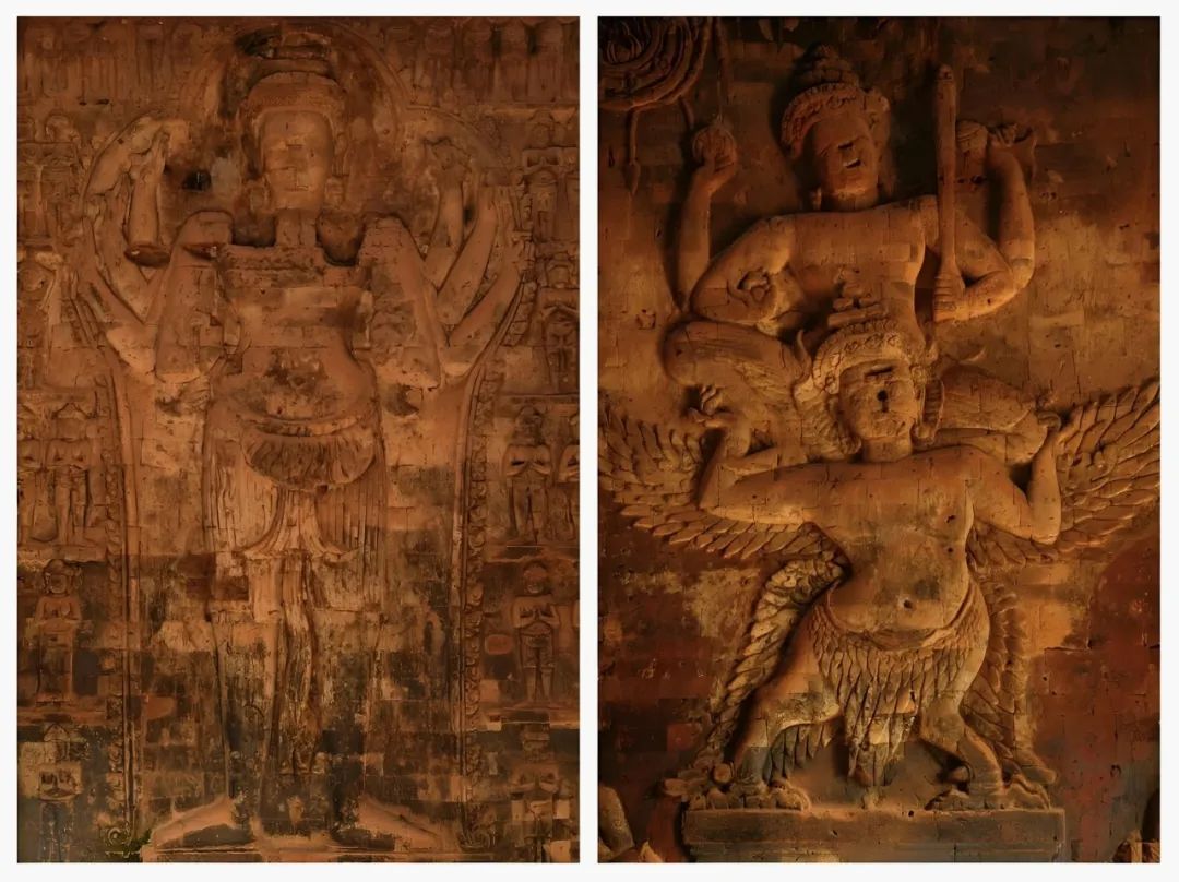
The picture shows the relief sculpture in the pagoda of Cardamom Temple
Finally, there is something special. I wonder if you have discovered that Cardamom Temple should be the first temple dedicated to Vishnu in Angkor. All the temples before were temples with Shiva as the main god. Although Bakan Temple has elements of Vishnu, the central tower still worships Shiva, and only Cardamom Temple. All towers depict Vishnu. This means that the Vishnu sect at that time had a certain mass base and was gradually rising, laying the foundation for the subsequent replacement of the Shiva sect.
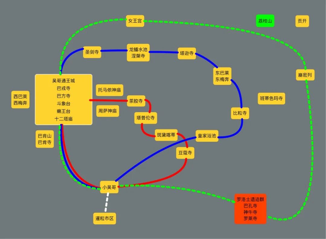
Well, this article ends here, let’s leave the remaining attractions in Angkor to the next article. I will present this road map for Siem Reap, see you in the next article.
The picture shows the roadmap of this article